
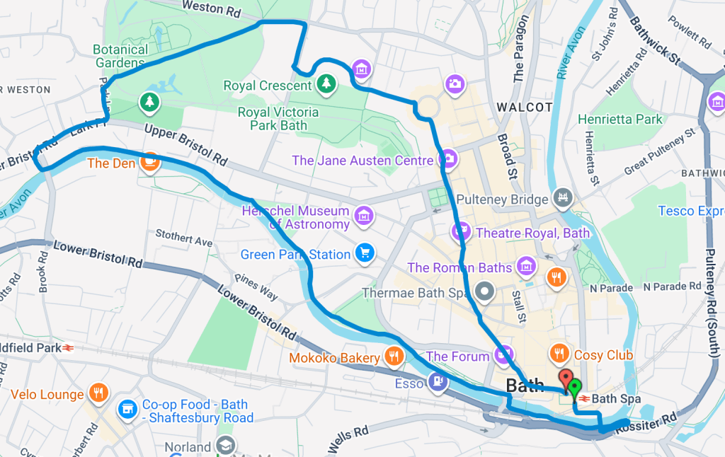
This route runs from Bath Spa Station along a scenic 5km loop through the city, taking in the canal path, Victoria Park, Royal Crescent and The Circus. It’s an easy, well-connected route that combines riverside paths, green space and some of Bath’s most iconic architecture.
Route safety info:
- Well-used shared paths with runners, walkers and cyclists throughout
- Mostly traffic-free sections, with short road crossings in quieter residential areas
- Suitable in daylight hours, parts of the route are less well lit in the evenings
- Busy in sections, but wide paths make passing easy
- Multiple exit points along the canal and city centre if you choose to shorten the route
Tap the route below to access the interactive route.
Download the GPX file and upload it to your Garmin or Coros app: Garmin/Coros GPX file
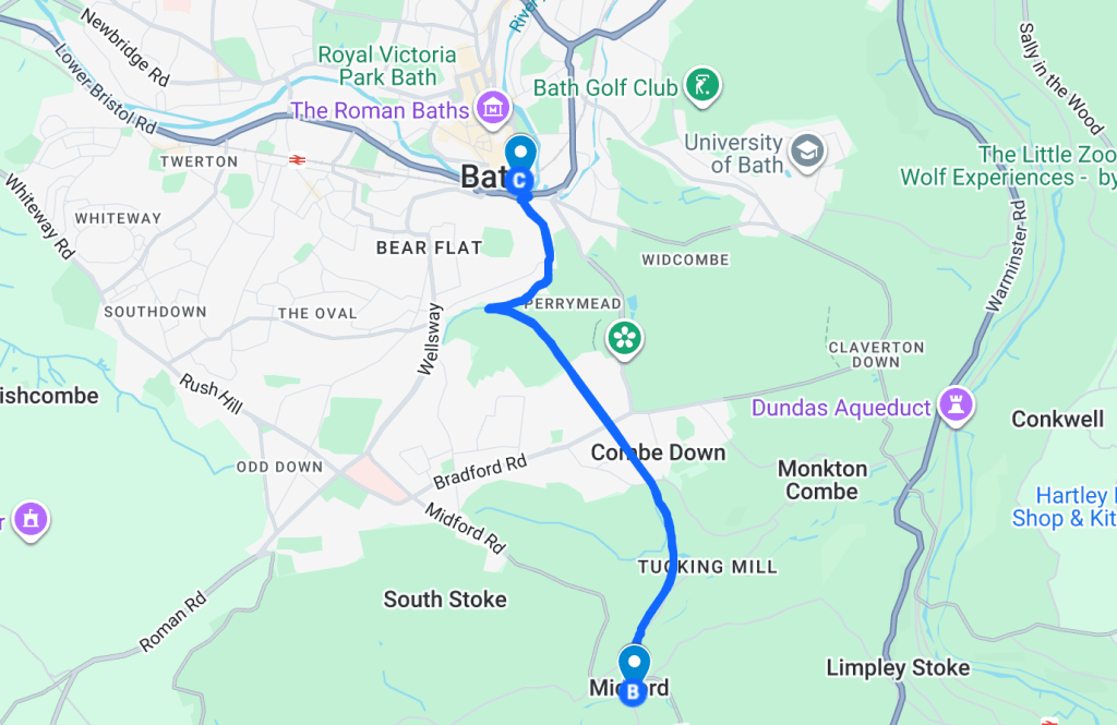
This route runs from Bath train station along a disused railway path, covering approximately 10km depending on your start and finish points. It features two tunnels:
- First tunnel: 408 metres
- Combe Down Tunnel: 1,672 metres, the longest cycling & running tunnel in the UK.
The route is flat and traffic-free, making it ideal for easy runs, tempo sessions, or interval training. It finishes near the city centre, perfect for your post-run coffee.
Route safety info:
- Traffic free, so there’s no need to worry about cars on this route
- Tunnels are lit, so you don’t need to worry about wearing a head torch for the tunnels
- Other parts of the path aren’t lit so I’d recommend not running this route in the dark
- Popular with runners and cyclists but wide paths make it easy to pass
Tap the route below to access the interactive route.
Download the GPX file and upload it to your Garmin or Coros app: Garmin/Coros GPX file
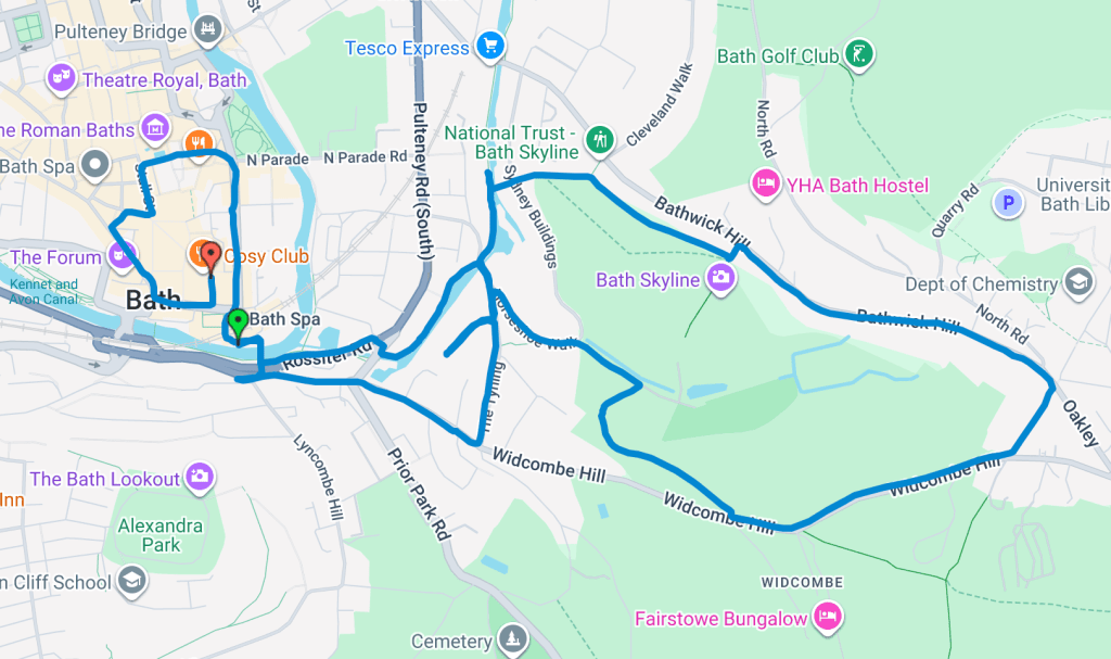
If you’re visiting Bath and looking for a shorter trail run with a challenge, this 5km Bath Skyline loop is a great option. With 178 metres of elevation, it offers a bit of a climb and rewarding views, all starting and finishing right by Bath Spa railway station.
The route takes you along a mix of trails through open countryside and peaceful woodland, with incredible skyline views stretching out across the city. It’s a brilliant way to experience Bath from a different perspective while getting a solid hill session in.
Route safety info:
- The route includes 178m of elevation, with steep climbs and descents, take extra care, especially in wet or muddy conditions
- Not well lit, so it’s not suitable for running in the dark
- Take your time on the downhills and wear appropriate trail shoes for grip
Tap the route below to access the interactive route.
Download the GPX file and upload it to your Garmin or Coros app: Garmin/Coros GPX file
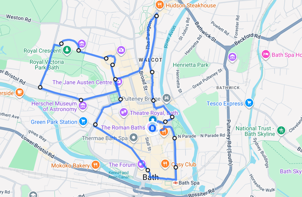
This route is a 5km loop around Bath, starting just outside Bath Abbey, which is about a 7-minute walk from Bath train station. It’s ideal if you’re visiting or heading out after work and a great option if you want to take in the sights while running through the city.
The loop runs entirely on well-lit streets, with street lamps along every road. When I tested this route there were other runners out. I ran this route between 6:30–7:30pm for reference.
Route safety info:
- Well-lit streets throughout, making it suitable for evening runs
- Central route through busy parts of the city, so you’re visible rather than running in isolated areas
- Other runners were out during this time window
- I felt comfortable running this route in the dark but this is my own personal judgement, always trust your instincts
- I’d recommend wearing reflective gear so you can be seen by others, especially in lower-light conditions
Tap the route below to access the interactive route.
Download the GPX file and upload it to your Garmin or Coros app: Garmin/Coros GPX file
canal PATH
This is a 14.13km point to point route starting in Bath and following the canal all the way to Avoncliff. It’s a beautiful, peaceful path with light foot traffic. You will pass other runners along the route. Head to Number 10 in Avoncliff for your post-run cake and coffee afterwards.
Route safety info:
- Be aware of traffic for the first 2km of this run, as you’ll need to cross a couple of roads to reach the canal path.
- Be mindful of walkers and cyclists sharing the path
- The path is not lit at night, so it’s not recommended for evening runs
Tap the route below to access the interactive route.

Download the GPX file and upload it to your Garmin or Coros app: Garmin/Coros GPX file
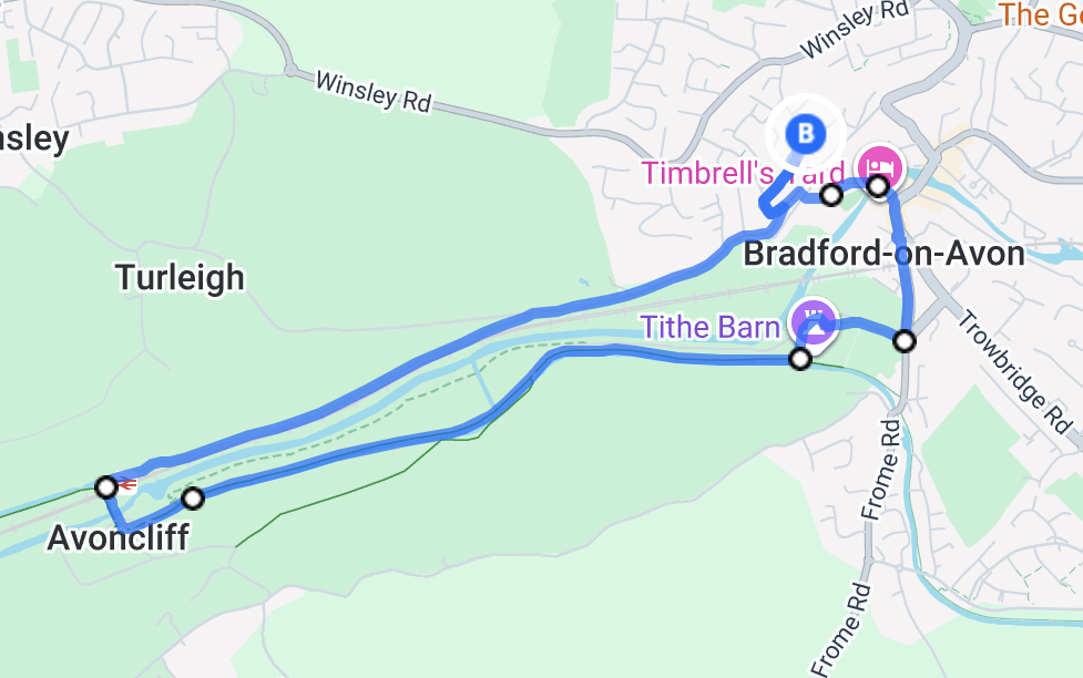
canal Loop
This 5.8km canal loop is ideal if you’re looking for a scenic route. The route is mostly flat with an incline towards the end (last 100 metres). The route is easy to follow and popular with walkers, cyclists and runners throughout the day. With train stations at both Bradford-on-Avon and Avoncliff, it’s easy to access by train if you don’t live close by.
Route safety info:
- There is a slight incline in the final (100 metres), no one will judge you if you walk it.
- Be mindful of walkers and cyclists sharing the path
- The path is not lit at night, so it’s not recommended for evening runs
Tap the route below to access the interactive route.
Download the GPX file and upload it to your Garmin or Coros app: Garmin/Coros GPX file
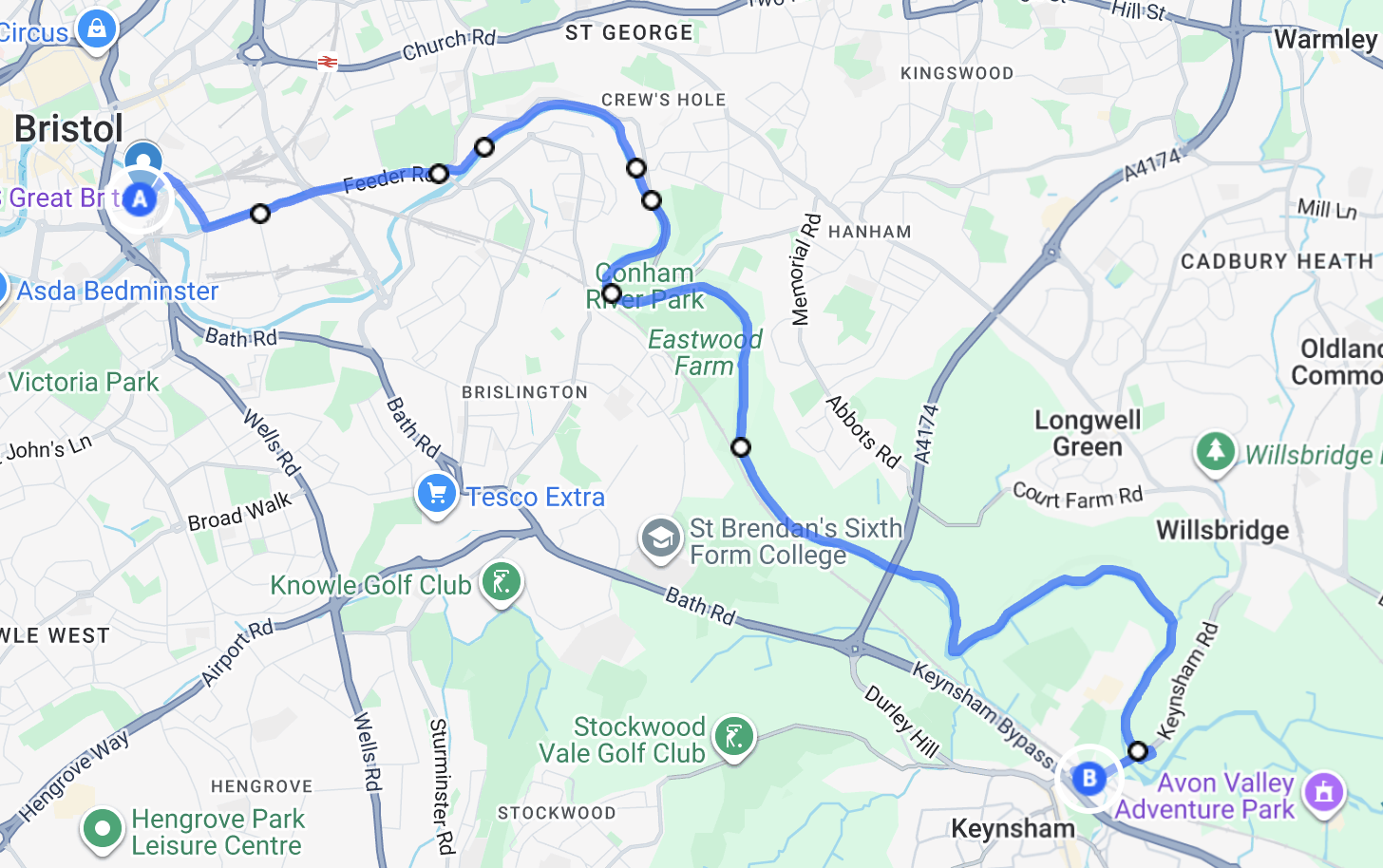
BRISTOL TO KEYNSHAM
This is a 12.16km point-to-point run from Bristol Temple Meads to Keynsham, following the River Avon through Conham River Park. It includes a mix of paved paths and trail sections, with mostly gentle terrain throughout. Although the route has a total elevation gain of 74m, the climbs are gradual and it doesn’t feel particularly hilly.
Route safety info:
- There are a couple of access points along the route
- Best run in daylight hours, particularly during the trail sections through Conham River Park
- The route is generally easy to follow, although some trail sections can become muddy after wet weather
- There were regular walkers, runners, and cyclists when tested, making it feel comfortable for solo running
Tap the route below to access the interactive route.
Download the GPX file and upload it to your Garmin or Coros app: Garmin/Coros GPX file
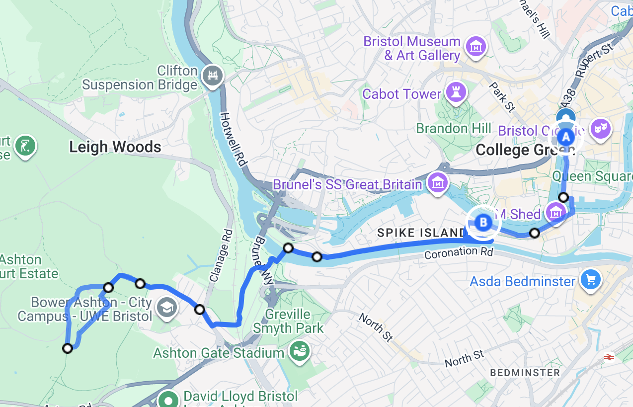
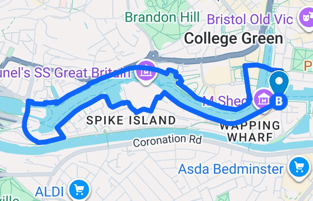
ASHTON COURT ESTATE
This is an 8-10km run from Bristol Harbour to Ashton Court and back. It includes a mix of tarmac paths, compact gravel and light trail sections, with mostly even terrain throughout.
The route follows Bristol’s waterfront before joining the Chocolate Path and continuing towards Ashton Court. Along the way, you’ll be treated to several views of the Clifton Suspension Bridge before reaching one of Bristol’s most popular green spaces.
Route safety info:
- There are multiple access points where the route begins.
- Best run in daylight hours. As there’s not much lighting in Ashton Court
- Visibility is generally good but take care on narrower sections where there could be other cyclists and pedestrians.
- The route felt busy enough with walkers and runners when tested, making it comfortable for solo running.
Tap the route below to access the interactive route.
Download the GPX file and upload it to your Garmin or Coros app: Garmin/Coros GPX file
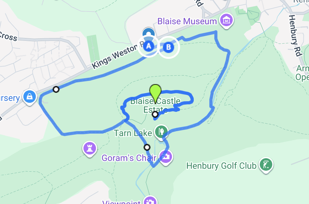
BLAISE CASTLE ESTATE
This loop route is a 4km run in Blaise Castle Estate in Bristol. It includes a mix of tarmac paths, woodland trails, stairs and muddy sections, with approximately 89m of elevation.
It leads up to Blaise Castle, an 18th-century “sham castle” built as a decorative landmark rather than a functional castle. There is a car park on site and the area is also accessible by bus from Bristol city centre and Bristol Temple Meads. The route finishes near the Blaise Castle Café, located by the main entrance and car park.
- The route is best run during daylight hours as there are no street lamps across the estate.
- There are multiple path junctions and stairways throughout the estate, so navigation may require attention, particularly when first using the route.
- The terrain varies throughout with tarmac, woodland paths and uneven/muddy sections.
- There is a car park at the main entrance
Tap the route below to access the interactive route.
Download the GPX file and upload it to your Garmin or Coros app: Garmin/Coros GPX file
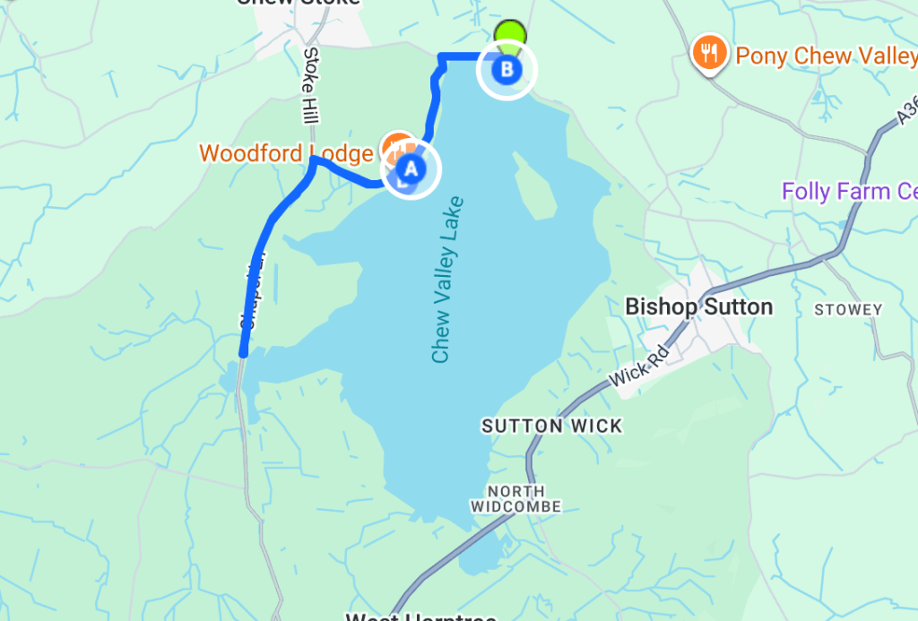
CHEW VALLEY LAKE 6KM
This out-and-back route is a 6km run set just outside Bristol. Following peaceful lakeside paths with plenty of wildlife along the way, it’s a great option for an easy or steady run. There are multiple car parks nearby, with free parking after 6pm (just be mindful that the car parks close at 8:30pm). The route is pretty much flat the whole way and easy to follow. There’s even a fish and chip shop at the finish for your post run snack.
Route safety info:
- The route is best run during daylight hours. The car park closes at 8:30pm, so I wouldn’t recommend starting your run any later than 7pm.
- There are multiple access points throughout the route, with a restaurant located in the main car park where the route begins.
- Visibility is generally good, but take extra care on narrower paths and less maintained sections.
- There were also other walkers and runners around when I tested the route, which made it feel more comfortable and safe to run solo.
Click on the map to find the starting point
Download the GPX file and upload it to your Garmin or Coros app: Garmin/Coros GPX file
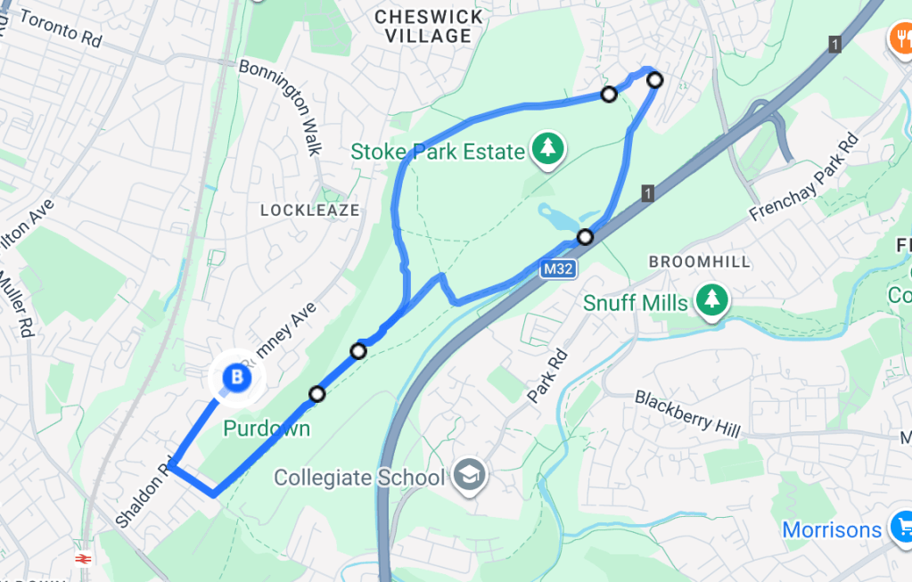
Stoke Park Estate Loop
The Stoke Park Estate loop is a 6km route set just outside Bristol, starting near Romney Road (lots of free parking on this road if you drove). The route is mostly even terrain with a mix of compact trail and open park paths, making it ideal for an easy or steady run.
There are a number of paths to explore, with optional detours around a small pond and across a narrow bridge for those who want to venture slightly off route. The park is popular with other runners and walkers, which can make it feel more comfortable and the route is free from traffic.
Route safety info:
- The route is best during daylight hours.
- Surfaces include compact trail and grass paths, which can become uneven or muddy in places.
- There are multiple access and exit points throughout the park if you need to shorten the run.
- Visibility is generally good, but take care on narrower paths and less maintained sections.
Tap the route below to access the interactive route.
Download the GPX file and upload it to your Garmin or Coros app: Garmin/Coros GPX file
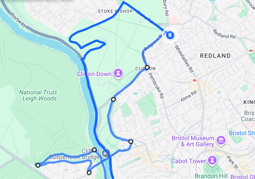
Bristol Portway Loop
The Bristol Portway loop is just over a 10km loop starting on Clifton Downs. There is a mix of road and trail running, with some steep inclines and uneven terrain. The route is suitable for runners looking for a long run.
The loop follows the Portway, running alongside the River Avon, through Leigh Woods and along the Bristol Suspension Bridge.
Route safety info:
- The route is best during daylight.
- Surfaces include tarmac and trail, trail sections can be uneven.
- The route includes hills and a steep incline up to Leigh Woods.
- Visibility is generally good but be careful when crossing the road along the Portway.
Tap the route below to access the interactive route.
Download the GPX file and upload it to your Garmin or Coros app: Garmin/Coros GPX file
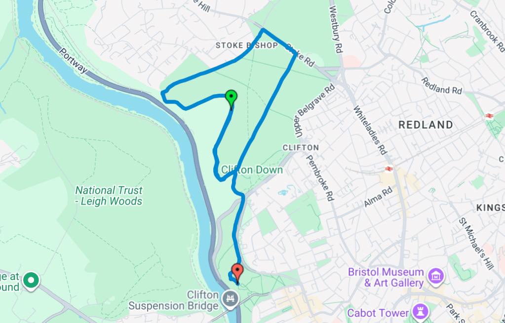
CLIFTON DOWNS
Clifton Downs offers a scenic 5km (can be longer or shorter) loop in Bristol, with open space, greenery and mostly flat paths. The route is ideal for an easy jog, a tempo run or a casual walk.
The Downs is a popular spot for runners and there are public toilets along the route. The route provides views of the Clifton Suspension Bridge, designed by Isambard Kingdom Brunel and takes you close enough to appreciate it up close.
Route safety info:
- Paths are mostly flat and even, suitable for runners and walkers of all levels.
- Open spaces and greenery provide good visibility but always stay aware of other users.
- Public toilets are available along the route if needed.
- The route is best used during daylight hours as there is no after dark.
Tap the route below to access the interactive route.
Download the GPX file and upload it to your Garmin or Coros app: Garmin/Coros GPX file
Bristol Harbour Loop
This is a 4.4km route but it also works well for other distances if you prefer running in laps. The path is flat, easy and is commonly used by lots of other runners throughout the day.
Route safety info:
- Well lit all the way around the harbour, making it safer in darker conditions
- High foot traffic on weekends, which can feel crowded at times
- There are always other runners around the harbour, this is a popular running route
Tap the route below to access the interactive route.
Download the GPX file and upload it to your Garmin or Coros app: Garmin/Coros GPX file
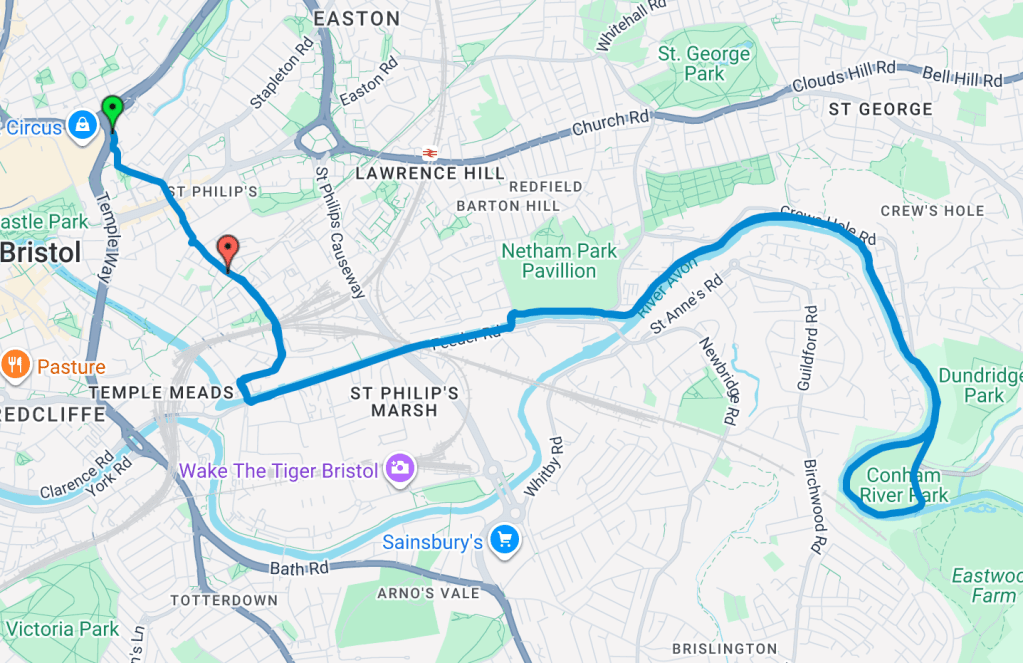
conham river park out and back
This is a 10km out-and-back route starting at Bristol Temple Meads and running along the river path towards Conham Park before returning the same way. The route is mostly flat with a mix of paved and short gravel sections, making it suitable for steady runs, long runs, or easy pace sessions.
Route safety info:
- The majority of the route runs along quieter riverside paths, away from main traffic
- There are a few road crossings when leaving Bristol city centre, so take care at junctions
- The riverside path is shared with runners, walkers and cyclists, so be mindful of others along the way
- Some sections are not well lit after dark and the riverside path is quite secluded, so it’s best run in daylight or when you feel comfortable with visibility
Tap the route below to access the interactive route.
Download the GPX file and upload it to your Garmin or Coros app: Garmin/Coros GPX file
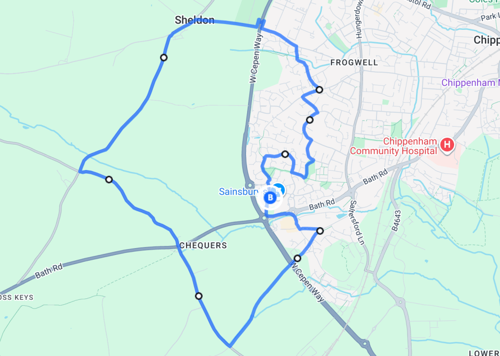
chippenham Countryside Loop
This loop is just under 10km along country roads. It’s mostly flat with an elevation gain of 53m. It’s perfect for a morning or daytime run, but avoid rush hour as you can expect more traffic on the roads.
Route safety info:
- The lanes are mostly quiet but cars do use them especially during rush hour, there are grass verges all along the way so you can step aside safely
- Stay safe on the roads, I’d strongly recommend no music while running this route
- There are a few places you can stop along the way to take in the views or rest
- Sainsbury’s car park allows you to park there for 2 hours if you’re not local
Tap the route below to access the interactive route.
Download the GPX file and upload it to your Garmin or Coros app: Garmin/Coros GPX file
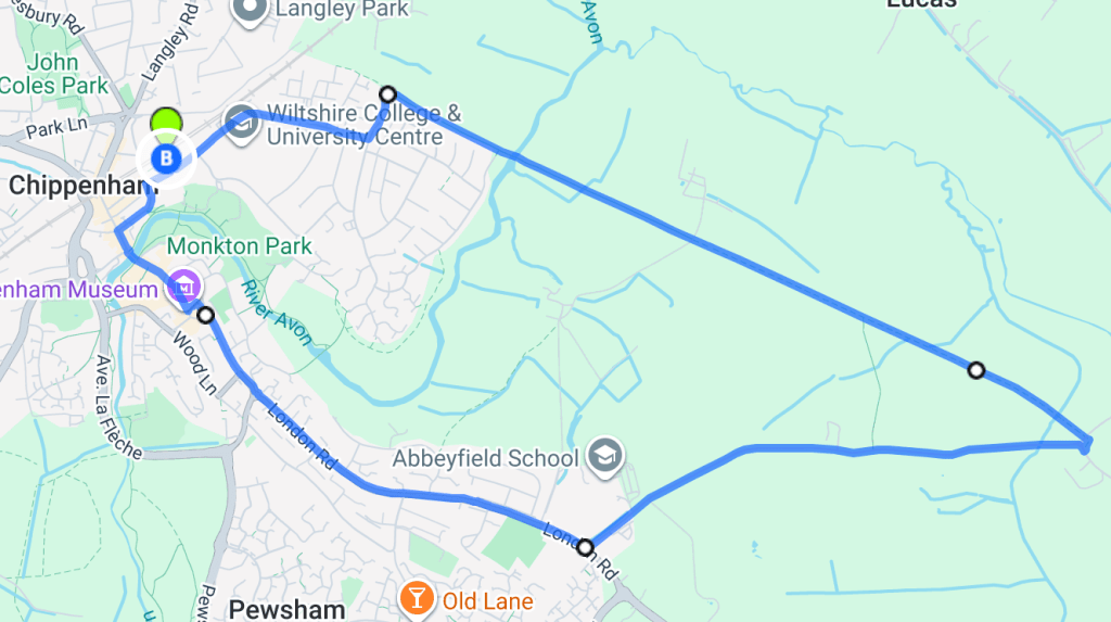
chippenham railway Loop
This loop is just over 8km but it’s also perfect for a longer run to Calne (the path is 10km from Chippenham to Calne) if you fancy going all the way. The path is flat, easy and mostly traffic-free, following an old railway line through scenic rivers and countryside.
Route safety info:
- The route is mostly traffic-free, but not well lit, so it shouldn’t be run at night
- Start and end at Chippenham Train Station, perfect for getting to the route without a car but there are also places to park closer to the railway path if you’d prefer
- While the path is popular with runners, cyclists, and walkers, you’ll often have plenty of space along the way
Tap the route below to access the interactive route.
Download the GPX file and upload it to your Garmin or Coros app: Garmin/Coros GPX file
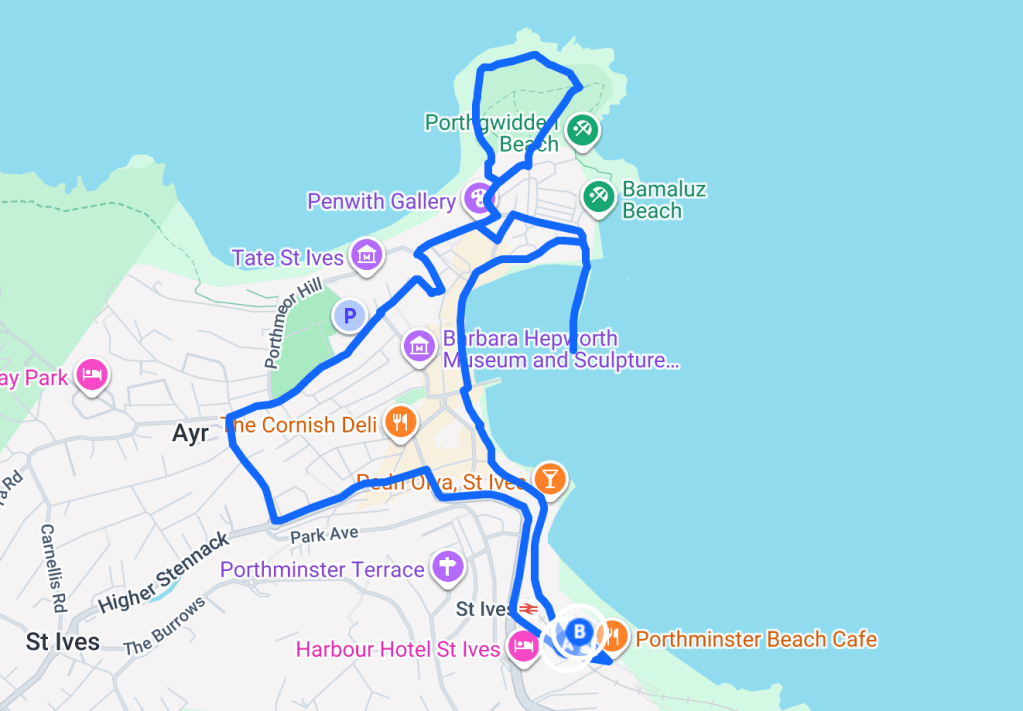
St Ives Loop
This scenic coastal route is just under 5km and follows the South West Coast Path around St Ives, offering uninterrupted sea views and passing many beaches along the way. The route is best suited to runners and walkers due to the terrain. While the path is well maintained, there are several hillier sections, so expect a few climbs and uneven coastal ground underfoot.
You can get here by car or via the scenic coastal train line into St Ives, which is considered one of the most beautiful rail journeys in the UK.
Route safety info:
- Exposed coastal path with little shelter from wind
- Hilly sections with uneven terrain in places
- Shared with walkers, take care on narrower stretches
- No lighting along the coast path, so this route isn’t recommended after dark
Tap the route below to access the interactive route.
Download the GPX file and upload it to your Garmin or Coros app: Garmin/Coros GPX file
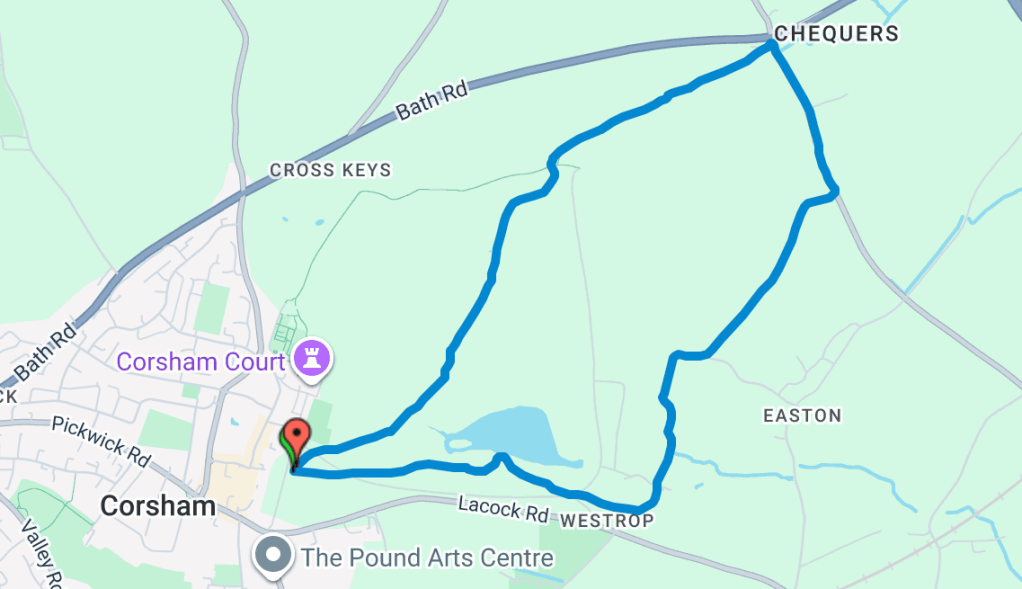
cORSHAM COURT Loop
This is a 5km loop around Corsham Court in Wiltshire. It’s more of a trail route so I would suggest wearing your trail running shoes or trainers you don’t mind getting dirty. It’s in open fields and down quiet country lanes which makes it a peaceful loop. You start and finish by the town centre so you can get yourself a coffee/snack at the end. There’s quite a bit of parking in Corsham and it’s free for the first 2 hours.
Route safety info:
- This route is mostly traffic-free. There are a few stretches along quiet country lanes, so please stay aware of occasional cars.
- There is no lighting around Corsham Court, so this route is best enjoyed as a daytime run. If you are running in the dark, a head torch is strongly recommended.
- Corsham Court is a popular area for dog walkers and fellow runners. You may also encounter sheep in the surrounding fields.
Tap the route below to access the interactive route.
Download the GPX file and upload it to your Garmin or Coros app: Garmin/Coros GPX file
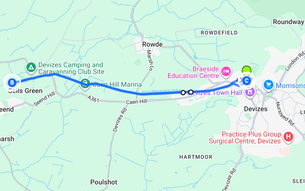
KENNET AND AVON CANAL OUT & BACK
This is an out-and-back run along the Kennet and Avon Canal in Devizes, starting from Caen Lock Hill. You start at the top of the hill and head down towards the canal, which makes for a very enjoyable start. Just keep in mind that whatever you run down, you will have to run back up at the end. The return includes a 77m elevation climb, so be prepared for a slightly more challenging finish.
There are benches along the route if you need to stop and take a break, and it’s a popular spot for dog walkers and other runners, so you won’t feel too isolated.
Parking is available at the top of the hill and costs around 90p per hour.
Route safety info:
- This route is mostly traffic-free, following the canal path throughout.
- The path is shared with walkers, cyclists, and dogs, so please stay aware of others around you.
- There is limited lighting along the canal, so this route is best enjoyed during daylight hours. If running in low light, a head torch is recommended.
- The surface is generally even but can be slightly uneven in places.
Tap the route below to access the interactive route.
Download the GPX file and upload it to your Garmin or Coros app: Garmin/Coros GPX file
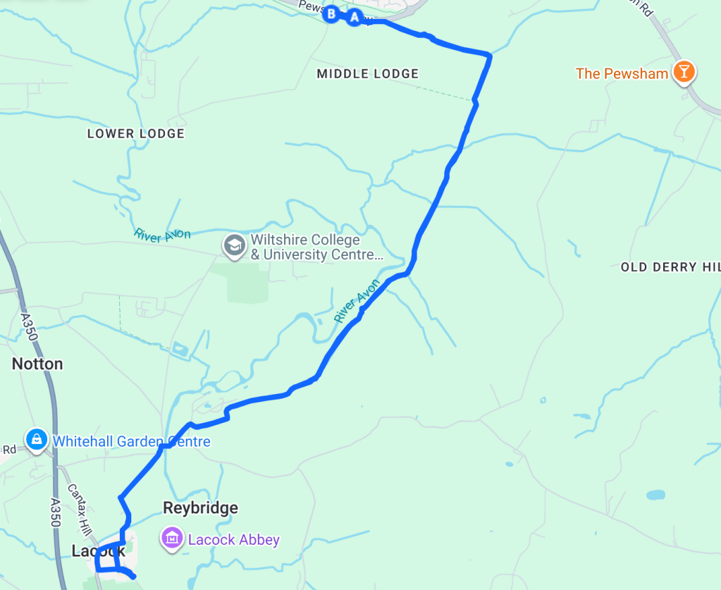
CANAL OUT & BACK
This flat, scenic 10km route follows the canal from Pewsham all the way to Lacock along a peaceful, well-maintained path that’s ideal for running or walking and a lovely way to spend time out in nature.
The route is quiet and traffic-free, with countryside views the whole way. It’s best suited to runners and walkers (not cyclists) and while the path is well kept, there are a few stiles along the way which mean a little stop-and-start as you go.
A highlight of this route is the mid-point stop at The Stables, the perfect excuse for a coffee and cake before heading back. To get to Pewsham you can either drive or get the bus from Chippenham train station. Alternatively you could get the bus to Lacock and run the route in reverse.
Route safety info:
- Completely traffic-free — no cars to worry about
- Well-maintained path shared by walkers and runners only
- There are a few stiles to cross along the route
- The path is not lit, so this route isn’t recommended after dark
Here’s the W3W for the starting point: https://what3words.com/enable.soon.rare
Tap the route below to access the interactive map.
Download the GPX file and upload it to your Garmin or Coros app: Garmin/Coros GPX file
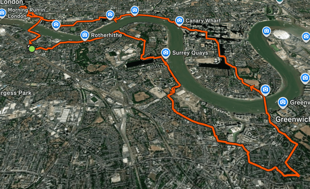
PITCHBLACK LONDON ROUTE
This 21km night route was sent to me by pitchblackevents, who host after-dark running events across London designed around exploration and navigation rather than fixed routes.
There’s no set route, the challenge is simply to reach four checkpoints: Stave Hill, The Point at Greenwich, Eden Dock in Canary Wharf and Leadenhall Market. Along the way you’ll cross the River Thames both over and under, creating a unique way to experience the city at night.
Route safety info:
- There are some busy roads in sections so watch the crossings
- Parts of the run are unlit so if you’re running the route at night, reflective gear and a head torch are strongly recommended
- Some parts of the run are in more secluded areas of London so if you don’t feel comfortable running solo drag a friend along
- The lift at Greenwich Foot Tunnel occasional stops working overnight so just bare that in mind
Download the GPX file and upload it to your Garmin or Coros app: Garmin/Coros GPX file
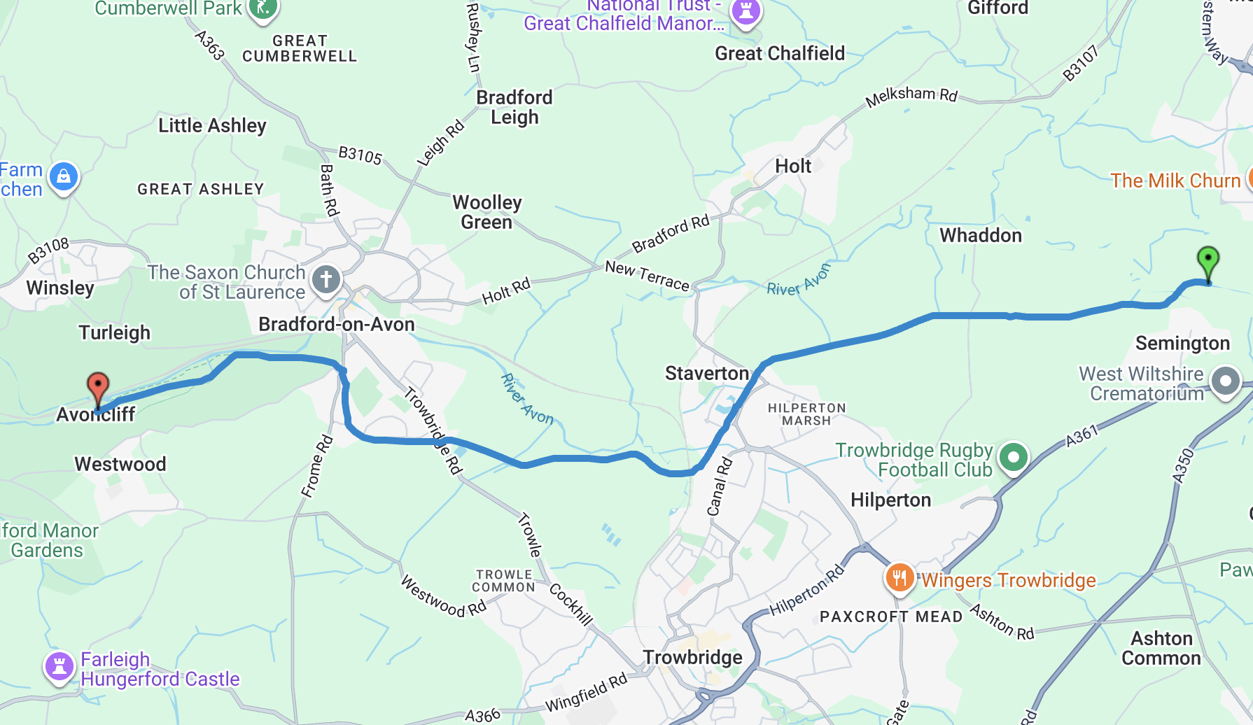
canal PATH
This is an 8.5km point-to-point route from Semington to Bradford-on-Avon, following the canal path through the Wiltshire countryside. You can extend the route to just under 11km by continuing on to Avoncliff. It’s a flat, peaceful route with very little traffic and a mix of runners, walkers and cyclists along the way. A perfect stop for coffee is Number 10 in Avoncliff if you choose to extend your run.
Route safety info:
- Be mindful of cyclists and pedestrians sharing the canal path
- The path is narrow in places at the start but widens as you approach Bradford-on-Avon
- The route is not fully lit, so not recommended for night running
Tap the route below to access the interactive route.
Download the GPX file and upload it to your Garmin or Coros app: Garmin/Coros GPX file
